This is a hike with amazing views of nearly the whole Kebler aspen forest and of many mountains in the area. The loop is perfect for a medium-length hike to explore this region with options to shorten it with good turnaround viewpoints. There are few better places to experience fall than here in the largest continuous aspen forest in the state. Late September and early October are typical peak foliage times.

| Highlights: | Aspen, Mountain Views |
| Difficulty: | Moderate |
| RT Length: | 6 miles |
| Approx. Time: | 3.5 hours |
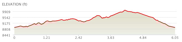
| Elevation Gain: | 1,102 feet |
| Max Elevation: | 9,948 feet |
| Trailhead Elevation: | 8,947 feet |
| Travel Time to TH: | 30 minutes |
Click photos to view multi-season gallery


Directions
From the Town of Crested Butte: Take Whiterock Ave. west through town as it turns into Kebler Pass Road. Follow the road 11.7 miles over Kebler Pass and turn right at the sign for Horse Ranch Park. Go straight ahead and park at the outhouse [1]. The Dark Canyon & Dyke Trail trailhead signs are just another .10 mile walk up the dirt road past the green gate [2]. Map
Route
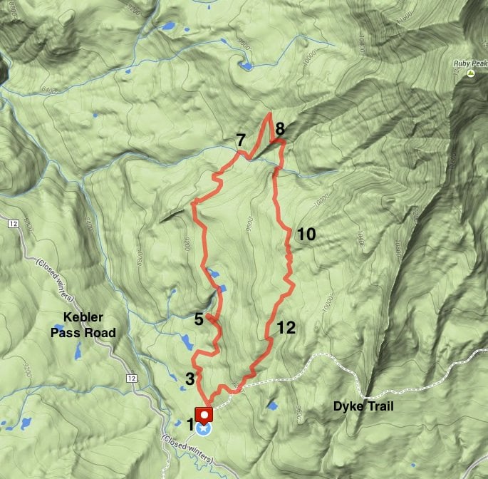
For the entire loop, keep in mind you'll be making right turns at every junction (there are a few) if you go clockwise starting on the Dark Canyon trail. Start off on an easy climb and pass many viewpoints of the Beckwith Mountains, beaver ponds, and surrounding Kebler aspen [4]
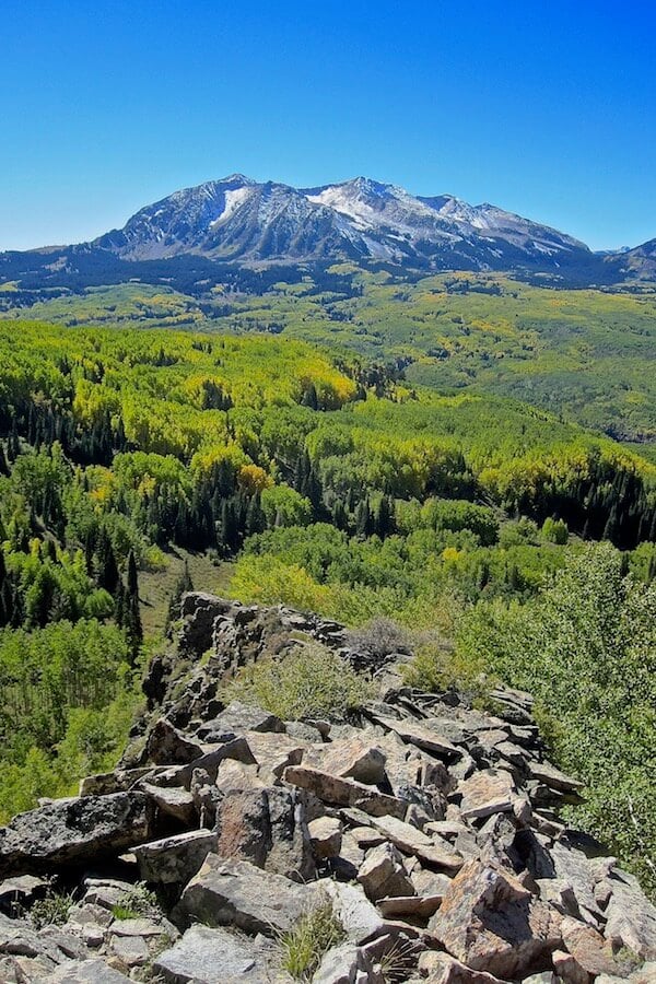
along the way. Views of Ruby Peak and The Dyke can be seen as you make your way through a couple of meadows. Before you reach the 2 mile mark, there are two rocky outcroppings on the left side, which offer expansive viewpoints [5]. Take a moment or two to breathe in the 50 mile view. This is a good turnaround point to keep your hike under 4 miles.
From the viewpoint it's just under a half mile to the first junction. Take the Oh Be Joyful Pass trail to the right and ascend a steep grade. At the next junction take a right onto the Lake Irwin trail as it winds through a rock spine [8]. Enjoy the views of Ruby peak from this part of the trail. Follow the descent and climb into meadows, which offer more excellent photo opportunities [11]. The next juntion takes you to the Dyke Trail and your next right. Descend another mile in thick aspen groves [12] back to the parking lot.

The climb up the rock spine is not advisable with many loose rocks and steep exposure adding risk.
Click photos to view multi-season gallery


Trail Map & Profile