
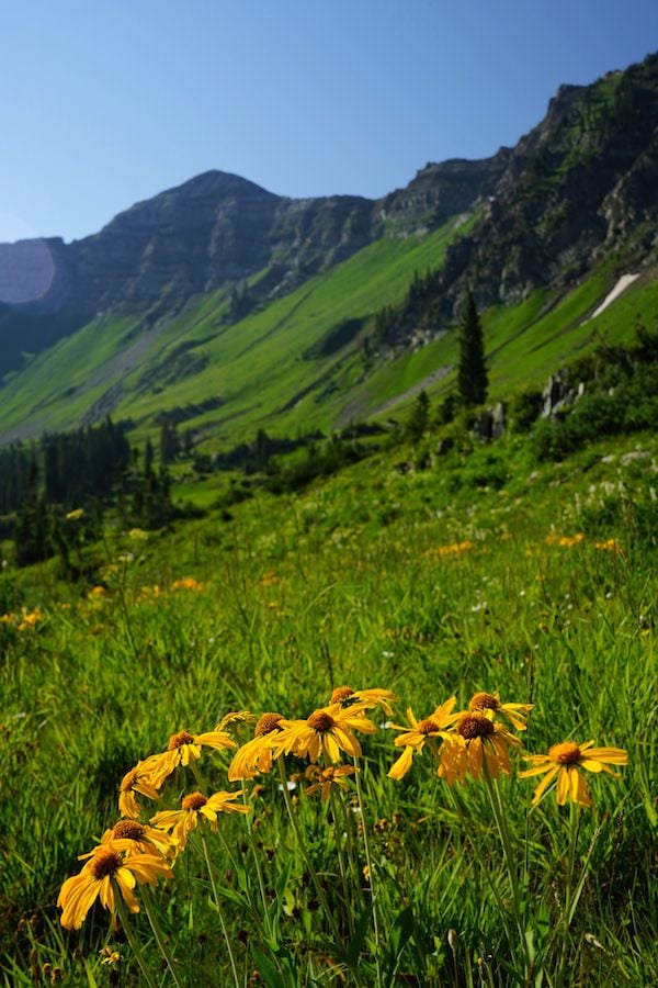
If timed right, this trail has it all. Dramatic mountain views extending for miles all the way to the Maroon Bells and Scarp Ridge. Waterfalls around every corner. Wildflowers of every variety completely blanketing steep hillsides. Even some tiny wild raspberries! This can be a hiking experience you won't soon forget.

Need a place to stay? Book at the Elevation Hotel and take 25% OFF lodging with promo code: travelcb
| Highlights: | Mountain Panoramas, Waterfalls, Wildflowers |
| Difficulty: | Very Strenuous |
| Length: | 4.6 miles |
| Approx. Time: | 3.5 hours |
| Elevation Gain: | 1,852 feet |
| Max Elevation: | 11,612 feet |
| Trailhead Elevation: | 9,791 feet |
| Travel Time to TH: | 45 minutes |
Click photos to view multi-season gallery


Directions
SUV required for the last 2 miles, otherwise add 4 miles to your RT. From the Town of Crested Butte: Take Gothic Road (135) north 0.8 miles to Slate River Road (734). Turn left and drive 7.2 miles up the valley to Poverty Gulch Road and a wide open gravel area (private property). There is no parking allowed here, so it's best to park along the road in a turn out prior to this spot or continue on. From this point an SUV with good clearance is required. Turn left and cross the Slate River, but check the depth. Pass waterfalls just after the crossing [1]. Drive 2 miles up a rocky and often deep puddle filled road. There is a parking area just before where the road crosses the creek. Park on the left side and do not drive across the creek (boulders block the road). Map
Route
Cross Poverty Creek over one of the many paths of logs or boulders [2]. Ascend the unmaintained mining road into Baxter Basin as the views begin to open up. Don't forget to look back for beautiful views of the gulch [3]. Keep an eye out for wild strawberries [4] and raspberries [5] in late summer.
Continue up the road, which can be lined with a variety of wildflowers later in the season. Keep an eye out for the left turn off of the road onto a narrow single track trail 1.6 miles up. This is marked by a small sign stuck in a rock pile [9]. The trail gets steeper and rockier as you get closer to the pass. The wildflowers get more dense and astounding as well [12]. Near the top, there are two gully crossings that are washed out and slippery. Be careful when crossing and watch your footing.
The steepest portion is just under the summit of Daisy Pass. From the top you can see a trail descending the other side down into Democrat Basin and Oh Be Joyful valley [15]. Take in the fantastic views of Scarp Ridge directly across from you as well [16].

Please don’t pick, cut, or walk on wildflowers or other plants. Removing wildflowers from the wild can adversely affect pollinators and other animals that depend on that species for food and cover and affect the flowers long-term survival in that location.
Click photos to view multi-season gallery


Trail Map & Profile


Enjoying this trail? Help support the people who maintain it. Donate to the Crested Butte Conservation Corps
Featured Lodging
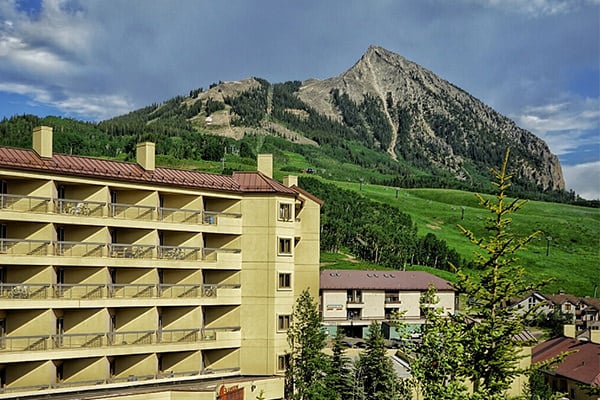
Elevation Hotel
Take up to 25% OFF with promo code: travelcb
500 Gothic Road • (970) 251-3000 • Directions
Elevation Hotel and Spa is Crested Butte’s only slopeside hotel. No matter the season, Elevation’s mountainside accommodations offer stunning views and unrivaled access to trails and the lifts at Crested Butte Mountain Resort. New must-see culinary concepts, bars and lounges include José, the Matchstick Lounge and the billy barr.
