
One of the most prominent peaks seen from town, Red Lady (Mt. Emmons) is a popular destination for backcountry skiers in the winter due to its close proximity and inviting slopes. Hiking to the summit will reward you with fantastic views in every direction, including Scarp Ridge, the town of Crested Butte, and Oh-Be-Joyful valley. Copley Lake offers a quick detour and quiet destination to kick back and relax.

Update 8/14/21 - User reports at 38.8817427,-107.0621618 on the upper FR 585 section up to the pass, there is now a large run-out gully that is ~20' deep and impassible without downclimbing ~300 feet and scrambling back up to the trail at the head of the basin. Alternate route to summit recommended.

| Copley Lake | Red Lady Summit | |
|---|---|---|
| Highlights: | Serene Lake, Wildflowers | Mountain Panoramas, Wildflowers |
| Difficulty: | Moderate | Strenuous |
| RT Length: | 3.5 miles | 10.4 miles |
| Approx. Time RT: | 2.5 hours | 5-7 hours |
| Elevation Gain: | 1,096 feet | 3,391 feet |
| Max Elevation: | 10,678 feet | 12,392 feet |
| Trailhead Elevation: | 9,577 feet | 9,577 feet |
| Travel Time to TH: | 10 minutes | 10 minutes |
Click photos to view multi-season gallery


Directions
From the Town of Crested Butte: Take Whiterock Ave west out of town as it turns into Kebler Pass Road. Drive 4.2 miles up the road (it will turn to dirt a few miles in) until you reach a small, unmarked parking area on the left side. There are 2 unmarked trails a few yards up the road from there on the right-hand side. Take the trail that is further up the road [1]. Map
Route

Some of the steepest terrain is right at the start for a few hundred meters. The trail mellows out relatively quickly, and keeps a moderate pitch the rest of the way to Copley Lake. Most of the trail goes in and out of spruce forest [2] with wildflowers along the hillsides. The trail climbs over 1,000 feet until you reach a junction in just under 2 miles [4]. A left takes you to Copley Lake[5] in under a quarter mile, a worthwhile detour either on the way up or down. Take a right at the cairn to continue toward the Red Lady summit.
Follow the double tracked old road [6]east and eventually start climbing a steep hill. There's an old trailer under a shed roof on your left toward the end of this trail. You'll then intersect a major dirt road and continue uphill and to the left (don't forget about this turn-off on your way back). You'll see the entrance to an active mine just up ahead [7]. Stay on the main road as it turns right, then switch backs left, passing the mine's active area [8]. Soon there is another junction. This time, the main road goes right, while you want to take the smaller road that goes up the hill, next to the gully with a lot of talus and mining debris. You'll start a series of long switchbacks and continue up the road into Elk Basin.[9]
The road turns to single track and the views expand to showcase East Beckwith Mountain [11] and the Kebler Pass area. At just under 4 miles in you'll come around a bend to reveal Gunsight Pass [12] and the remaining main climb. This part of the trail has some exposure and loose rock, so watch your step! From here, you can take in scenic views of Mt. Axtell [13].
Gunsight Pass is a reward in itself as you can finally see Gunsight Pass Road winding down into Redwell Basin along with much of the Elk Mountain Range. Walk around the locked gate [14 looking back] to continue the finally ascent of the summit. It's just another 15-20 minute hike from here on a well-defined trail. The summit is marked with Tibetan prayer flags[15].

Weather in the mountains can change very fast. During the summer months it is common to have thunderstorms developing during the afternoon in the high country. Check the weather forecast before you go. Keep your eyes on the clouds and know when to turn back.

For longer hikes its a good idea to carry a few extra things in your pack. Make sure to bring extra food and water, rain gear, a map or GPS, sun protection, and a flashlight in case your hike goes late. More information on what to pack can be found here.

Please don’t pick, cut, or walk on wildflowers or other plants. Removing wildflowers from the wild can adversely affect pollinators and other animals that depend on that species for food and cover and affect the flowers long-term survival in that location.

This trail is steep and has adverse trail condition. Loose rock can be found, tread carefully.
Click photos to view multi-season gallery


Enjoying this trail? Help support the people who maintain it. Donate to the Crested Butte Conservation Corps.
Featured Lodging
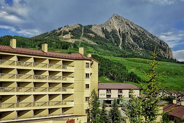
Elevation Hotel
Take up to 25% OFF with promo code: travelcb
500 Gothic Road • (970) 251-3000 • Directions
Elevation Hotel and Spa is Crested Butte’s only slopeside hotel. No matter the season, Elevation’s mountainside accommodations offer stunning views and unrivaled access to trails and the lifts at Crested Butte Mountain Resort. New must-see culinary concepts, bars and lounges include José, the Matchstick Lounge and the billy barr.

![[1]](https://travelcrestedbutte.com/wp-content/uploads/copley1.jpg)
![[2]](https://travelcrestedbutte.com/wp-content/uploads/IMG_5274.jpg)
![[4]](https://travelcrestedbutte.com/wp-content/uploads/IMG_5277.jpg)
![[5]](https://travelcrestedbutte.com/wp-content/uploads/FullSizeRender-38-copy.jpg)
![[6]](https://travelcrestedbutte.com/wp-content/uploads/IMG_5091.jpg)
![[7]](https://travelcrestedbutte.com/wp-content/uploads/IMG_5093.jpg)
![[8]](https://travelcrestedbutte.com/wp-content/uploads/IMG_5095.jpg)
![[9]](https://travelcrestedbutte.com/wp-content/uploads/IMG_5096.jpg)
![[11]](https://travelcrestedbutte.com/wp-content/uploads/FullSizeRender-38-1.jpg)
![[12]](https://travelcrestedbutte.com/wp-content/uploads/IMG_510w7.jpg)
![[13]](https://travelcrestedbutte.com/wp-content/uploads/FullSizeRender-39.jpg)
![[14 looking back]](https://travelcrestedbutte.com/wp-content/uploads/FullSizeRender-42.jpg)
![[15]](https://travelcrestedbutte.com/wp-content/uploads/copley2.jpg)