
Due to a conflict between the private land owners and the National Forest Service, we advise all hikers to avoid this trail until this issue is resolved. We'll continue to post any future updates.
A relatively quick hike on an old mining road will take you to a pristine water paradise. Summertime excursions to Green Lake near Irwin are the perfect escape, and offer a wildflower filled landscape surrounded by the peaks of Mt. Owen and Ruby. For those looking for a polar plunge, this should be on your list. Please respect the private property the road initially goes through by leashing your dogs, not trespassing, and parking lower down (see below for details).


| Highlights: | Mountain Views, Jump in the Lake, Wildflowers |
| Difficulty: | Moderate |
| RT Length: | 5.5 miles |
| Approx. Time: | 2.5 hours |
| Elevation Gain: | 1,365 feet |
| Max Elevation: | 11,727 feet |
| Trailhead Elevation: | 10,559 feet |
| Travel Time to TH: | 30 minutes |
Click photos to view multi-season gallery


Directions
From the Town of Crested Butte: Take Whiterock Ave. west through town as it turns into Kebler Pass Road. Follow the road 6.1 miles to the Lake Irwin campground turnoff onto dirt. Follow this dirt road another 2.5 miles to the campground and past the lake. Continue for another .4 miles and bear right at the fork. Park at the pull off another .3 miles up the road just before a solar paneled shed. Start the hike by bearing left at the fork by the shed. There is no parking past there until you pass another mile through private property on very rough 4x4 roads. Low clearance vehicles will get stuck and even SUVs can get a flat tire easily. Be sure to bring enough water, and do not trespass onto the private property (stay on the road). Map
Route
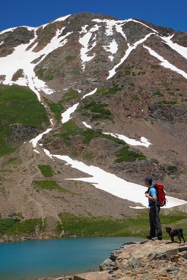
Much of this trail is on a 4x4 road and is well defined [1]. Follow the road as it winds up and along the base of the Ruby Range [2]. Ruby Peak (looker's left) and Mount Owen dominate the skyline in view. At about a mile in, cross over a creek and enjoy the wide views near tree-line just ahead. There are a few waterfalls to your left along the route as you traverse past Green Lake (from below) [3]. Bear left at about 2 miles at the junction for Green Lake (right will take you to Scarp Ridge) [4]. Follow the road as it gently ascends toward the lake. Once it finally comes into view, you'll wonder where the name comes from. When the sun shines, it's one of the bluest lakes in the area [5]. Descend down to the lake, soak up the views, and take a plunge ... if you dare.
Notes
You can continue up the road, past the lake to climb Mt. Ruby or Owen or just to get a different perspective. Wildflowers crowd around the lake in July [7]. The trail sees some snow as early as late September and October. The 4x4 road past the trailhead is rough, with sharp rocks. Low clearance cars will get stuck and even all wheel drive cars can flat easily.
Click photos to view multi-season gallery


Trail Map

More Hiking Guides:
Head back to the Hiking Guide for more hikes like this
Don't forget your Mountain Manners!
Want to see epic fall foliage during your hike? Check out these 6 Unforgettable Hikes
